

One of the most selective climbs in this year’s the Tour de France. If it’s not as fierce as the Angliru or Zoncolan, it still sits in a category of steep climbs that deserves to be explored in this series and ought to be raced more. So far it’s played a greater part in art history than the Tour de France.
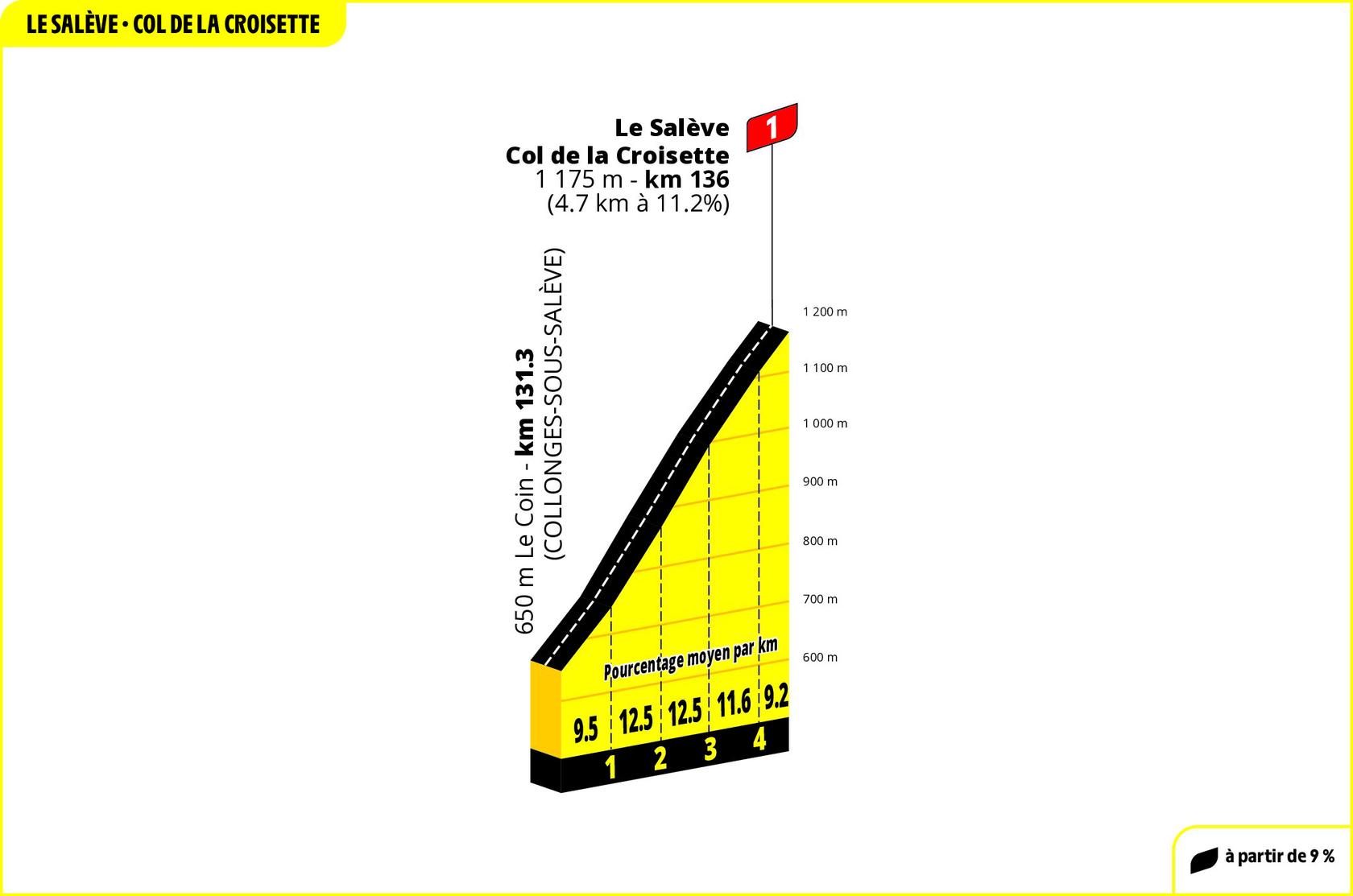
The Route
The D45 road climbs out of the village of Le Coin in the Haute-Savoie department of France. It is 4.7km with an average gradient of 11.2%. At the top is the Col de la Croisette, a crossing point in a dip along the ridge.

The Feel
This is one of those climbs you can see from afar. Photos don’t do the vertical gain justice. It looms with a cliff face some 800 metres tall. Apparently the name is derived from the Latin salire, to rise up or jump. Today in French it sounds like ça lève or “it rises”. You scan the mountain and know there’s road up but can’t figure out how it will work, just a vertical wall to scale.
The official climb might be only 4.7km long but to get there there’s a three kilometre ride mostly uphill too, it averages 5% but it’s irregular with flat passages and 12% ramps, climbing past the suburban villas and chalets of Archamps and Vovray. This is France but Switzerland is nearby, freshly-washed cars with Swiss plates sit on driveways.
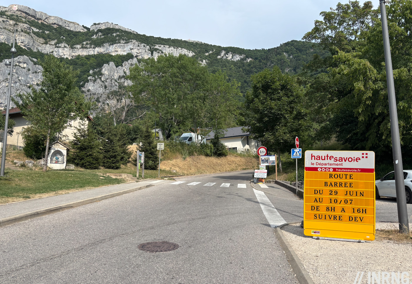
A ramp into Le Coin has your reaching for low gears and here you start the climb proper, passing the last few houses to reach a farm building at the first hairpin, the switch for town to countryside. This is where the forest begins and if you struggled to spot the road from afar it’s because it climbs up inside the woodland. And boy does it climb. You’re onto 12% ramps right away.
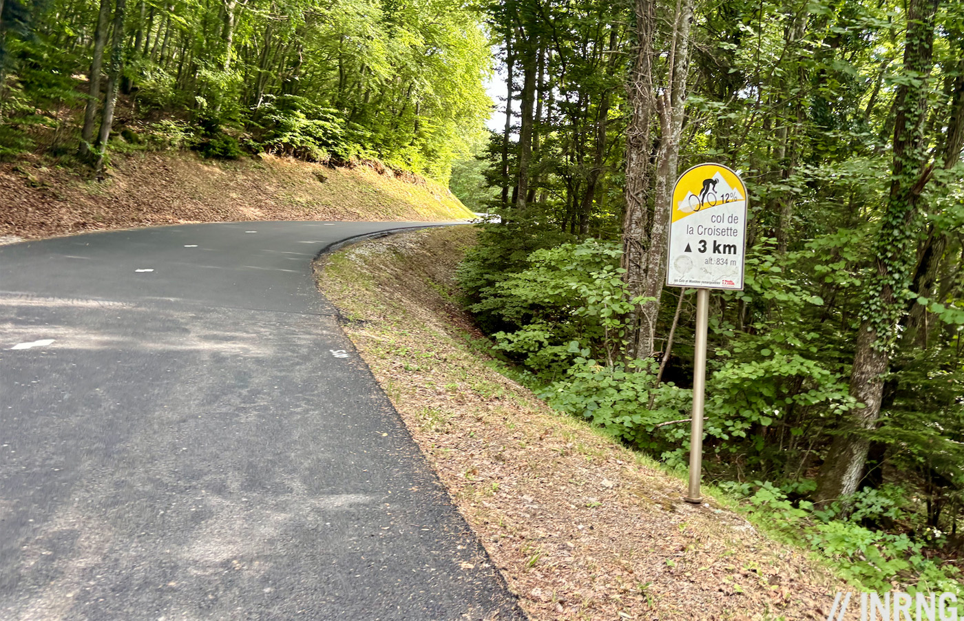
There are signs every kilometre for cyclists, a nice touch to value the road and warn of the constant double-digit gradients to come. It snakes up and the hairpins are even steeper. It’s the opposite of Alpe d’Huez, with its wide and flat bends in between each ramp. Here the corners are the steepest part of the road.
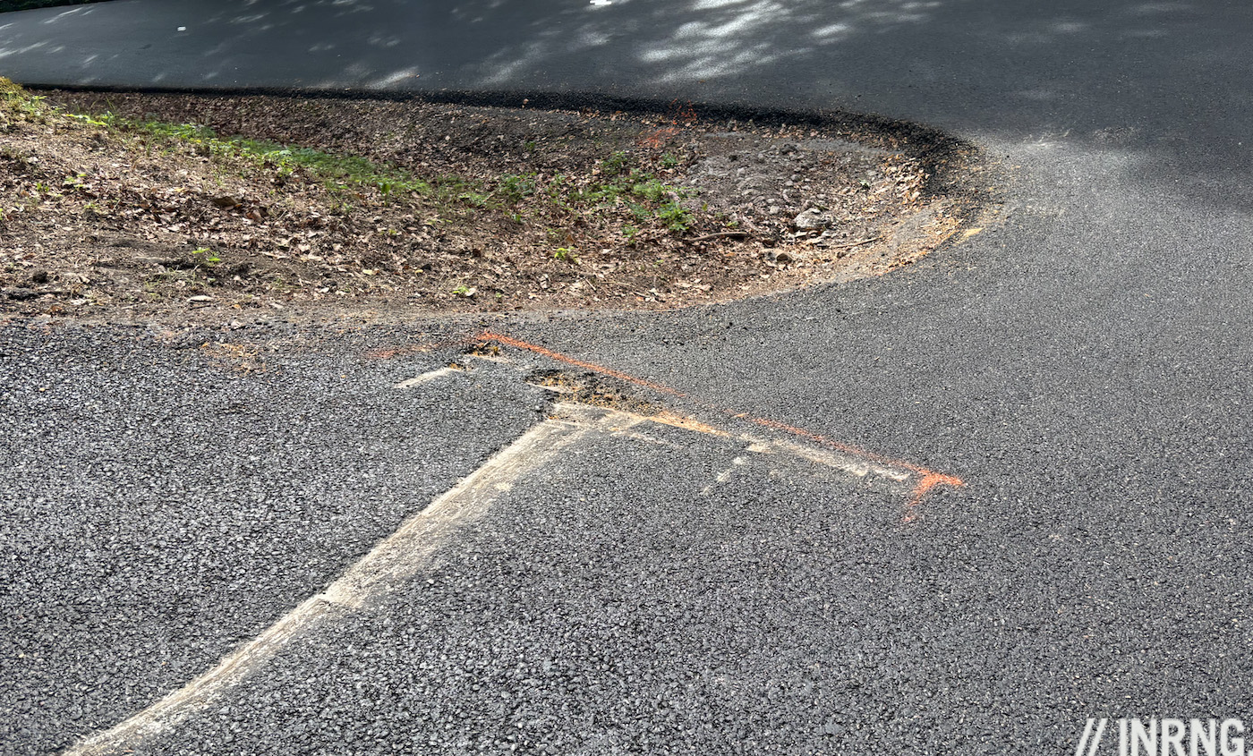
Climbing this on a late afternoon in June it had been freshly resurfaced for the Tour. But it was already scored by vehicles grounding their chassis on the inside of the bend because of the slope. There was some commuter traffic, people hurrying home. One van came past just before a bend and as it cornered clockwise around a hairpin its rear wheel on the inside was briefly hanging in the air before the van finished the bend and got all four wheels lined up on the slope.
It wasn’t busy or crowded but clearly used by some people in a hurry to get home, a daily rally that can’t be easy, or even an option, if it is dark and icy in winter.
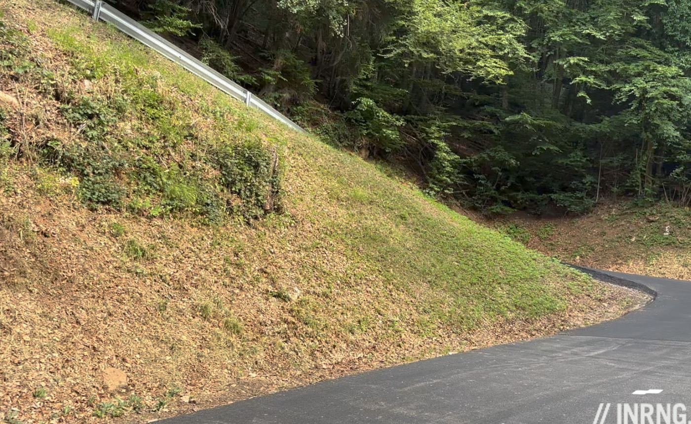
It’s steep but inconsistently so with 11% here, 14% there. Only there’s not a moment’s rest, it rarely eases below 9% and so makes for a constant winching effort. The changes in slope are never abrupt either.
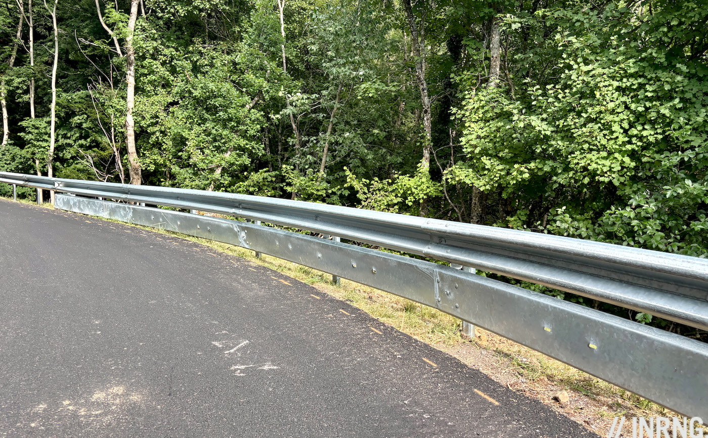
It’s punishing going up but barriers along the road have extra panelling to stop cyclists sliding out beneath so perhaps ascending is the better idea? Being in the woods means there are few views but occasionally you get a view and can appreciate how much you’ve climbed in a short distance.
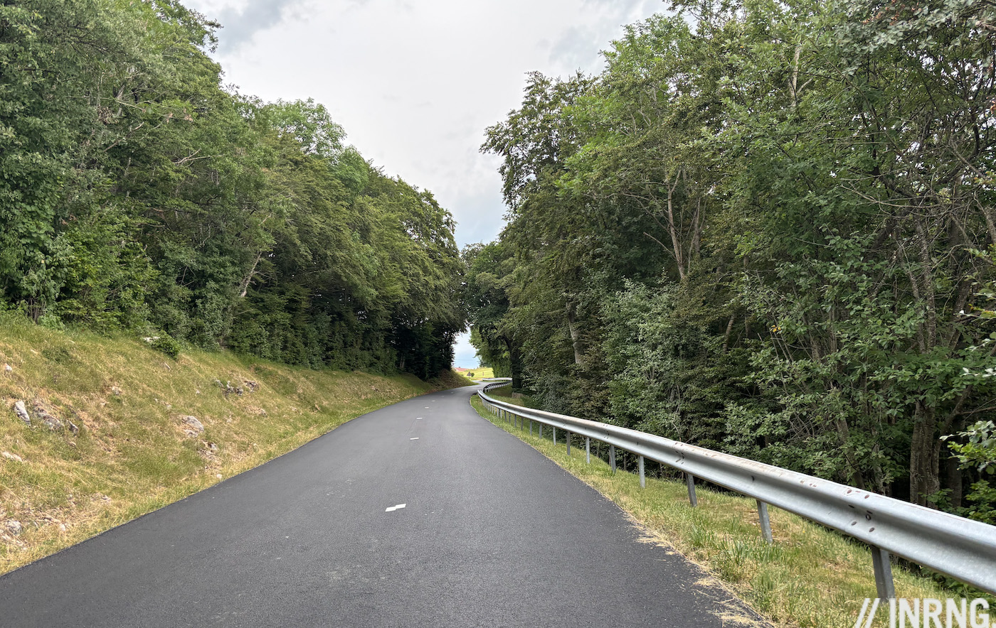
Clear the final hairpin and there’s still a way to go. Eventually the woodland gives way to grass pastures a small ski lift dangles in the wind but the slope still pins you back with double-digit gradients. Once at the top there are some buildings at the crossroads but look straight ahead beyond the railings for views of the Alps including Mont Blanc. This is one of those climbs with a payoff at the end, this time the panorama.
The Verdict
A climb just to get to the start. Once you climb out of Le Coin it’s harder still. Is it as hard as as Monte Zoncolan or the Mortirolo and other climbs we cite as references? No, but it does belong with them in a bracket of persistently steep climbs, the kind where it pays to think about your gearing because whatever works for normal Alpine climbs of 7-9% may not be sufficient.
It’s strictly a rural climb with woodland but does have a big population nearby. It’s a gateway climb, the city of Geneva and its surrounding suburbs extending in France sit on one side where locals get a gymnasium climb that leads to a new landscape beyond.
Ride More
Having scaled the cliff face there are some cafes and bars, plus a water fountain. You can turn left or right to ride along the crest top of the mountain to enjoy the views more before descending and being able to ride around to the start.
If you do go straight on, and down, you can find a way towards Annecy for more Alpine roads. Or try a hipster version of the 2026 Tour de France stage by going via the climb to the Plateau de Glières to take its grave road before tackling the Plateau de Solaison summit finish.

History
In terms of geology this is part of the Jura mountains. The cliffs of Mont Salève have long inspired artists. In 1444 Konrad Witz depicted biblical scenes in The Miraculous Draft of Fishes but each painting has a backdrop with recognisable landscapes, including the Salève whose striated cliffs are on the top right of the painting here. This is regularly cited by art historians as the first work to accurately depict recognisable landscapes.
The image at the top of this post is by landscape artist Théodore Rousseau, who features in a recent Substack post of Edward Pickering, the former Cycle Sport and Rouleur editor.
In 1815 Mount Tamboura erupted in what is Indonesia today and this is said to be the most powerful in recorded human history. It propelled so much rock, dust and gas into the atmosphere that the following year the debris reduced the sunlight around the world, causing temperatures to plunge and what was since branded “a year without summer”. Crops failed, people rioted. Amid this a 19 year old Mary Shelley was staying in Lord Byron’s villa near Geneva and she complained of the “incessant rain”. To pass the time indoors they told scary stories and from this Victor Frankenstein was born and two years later her story was published. Part of the story sees Frankstein pursue the hideous monster he created across treacherous terrain:
I thought of pursuing the devil; but it would have been in vain, for another flash discovered him to me hanging among the rocks of the nearly perpendicular ascent of Mont Saléve
Tour de France History
The Tour de France first climbed this mountain in 1973 and via the same steep road too. It was a crucial stage as Luis Ocaña won and took the yellow jersey which he’d keep to Paris.
The stage finish was in Aspro-Gaillard. Don’t look for it on a map because Aspro was a brand of aspirin. Its factory was in Gaillard, one of the first to mass-produce aspirin pills in France. The company sponsored the Tour de France, funding ambulances and medics at the race and quid pro quo it got a stage finish and start outside the HQ. A few other stages have had place names altered for sponsors but mercifully its rare.
The last time it featured in the Tour was in 1992. The Critérium du Dauphiné Libéré, in its pre-ASO ownership days, used it in 2008. The surprise is that it isn’t used more often by bike races. The Tour organisers have been trying to hunt out steep roads for a long time and this is the first time that it’s tackled during Christian Prudhomme’s time as race director.
Travel and Access
Geneva in Switzerland is the nearest city with good rail, road and air connections. It’s not a climb to travel a long way just to try by itself but sits at a transport crossroads with traffic from France, Switzerland and Italy passing by so worth stopping to enjoy the views at the top.
More roads to ride at inrng.com/roads
I am constantly amazed by this site. Our host gives us top notch pro cycling content. Alongside which comes helpings of entomology, geography, history, business, politics and more. Remarkable writing.
+1
So good!
The Aspro story made me think about Alto de Santo Emiliano in Asturias, visited by the Vuelta year in year out (more or less), which starts in Langreo, where the Felguera Bayer factory is, nowadays producing *all* the acetylsalicylic acid for every single Aspirina labelled Aspirina around the world (plus some 10% of the rest).
Not a great climb, but once you descend to Mieres you’re half a dozen kms away from La Pola de Lena from where you can start Gamoniteiru or the classic sequence Cordal-Angliru.
+2. Don’t forget the humour as well.
Yep. So much top-notching writing and incredible background. And somehow Messr. Le Ring provides all this without asking for subscriptions or even showing ads.
Seem to remember there is a cable car up it and lots of parapente action in suitable weather
Yes, a cable car to the north-east of the climb if anyone just wants to visit without cycling.
I’ve only been a reader for a few years so might be missing something, but presumably you mean etymology and not entomology 😉
You can have both, the etymology of Salève in this piece, or the ravages of the pine beetle in the Vosges in a recent post https://inrng.com/2026/07/ballon-alsace-postcard/
Mr or Mrs Ring, you never fail to amaze me.
Thanks, I missed that one! I did look in the archives but only found a reference to Froome’s insect-like build
It’s interesting how little interest there is in French place name research ; I can only compare it to England where there are countless books and even a dictionary and a thriving academic Society. There wasn’t a single volume in our very well resourced Mediateque.
I wonder if this is because there was never really a great break in French history compared to England? The Frankish takeover did not result in a wholesale change of language, the institutions of Roman Gaul persisted and were ultimately adopted in many ways by the new nobility. Many of the towns and cities seem to have recognisable versions of their Gallo Roman names ( and many villages are known by their Christian parish affiliation).
Here simply to echo the comments above. I’ve been a loyal reader of this blog for years and I don’t think it is recency bias to state that today’s post is among the best INRNG has ever produced. HC-level difficulty for the sheer number of topics covered in just a few paragraphs! One of the reasons I love cycling is that the sport has so many dimensions to explore, and this blog proves it on the daily. CHAPEAU!
+1. The grade of the writing rises with each ascent. Thank you INRNG! This is truly something special.
Interesting you compared it to the Zoncolan. When I looked into it my first thought was “mini-Zoncolan”. Its obviously not as long but seems a similar “coping pace” climb.
Much much less steep, but besides that, it sounds more Mortirolo style I’d say:
“It’s steep but inconsistently so with 11% here, 14% there. Only there’s not a moment’s rest, it rarely eases below 9% and so makes for a constant winching effort. The changes in slope are never abrupt either.”
Not as consistent as Zoncolan or abrupt with “relative rest” section like Angliru and many Spanish backroad climbs.
Thanks for the splash of art history and literature with my daily dose of Tour read-ahead! Great stuff as always!
If you’re around next month, there is a local event where you can climb 1, 2, 3 or 4 sides of the Salève with some closed roads: https://www.coppandy.org/les-parcours-de-la-4s-du-saleve
A bit like the Cinglés du Mont Ventoux …