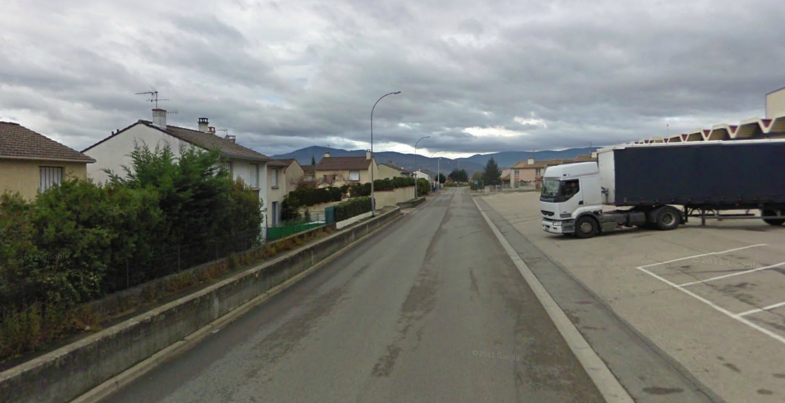
What do you think of the place above? The grey skies and the truck are obvious, a dull place on a dull day.
Look again and you can see the road is drying out, the dark parts bear witness to damp weather and suggest a rough surface where the water can briefly shelter from the breeze. Then look at the houses, they look economical and their steel shutters are closed, are they vacant? Weeds line the side of the road.
The image is from Google’s Street view. It’s a road somewhere in France, the kind of place that tourists avoid and you probably want to avoid. But tomorrow I’ll show just how different things can be.


OK I’ll go first…
I’m guessing a stage like Saint dié des Vosges – or maybe the start in the Territoire de Belfort
anyone?
St Dié is a good shout.
Big timber town surrounded by perfect motorcycling roads and not far from great wine country.
Alpe d’Huez?
Oh crumbs, this is going to be a long 2weeks if they’re all like this! 😉
hhahah nice one. I am sure we are in for a treat over Inrng’s holiday.
naked cyclists ?
Michele Ferrari meeting Johan B for a cup of coffee?
My 2 cents are on a back street of Bourg d’Oisans
Those hills in the background are far too low for it to be Bourg.
Feels more like up North. Paris-Roubaix or something along those lines?
The hills are too low to be Alps, but too high to be north of Paris. I would guess something in the Vosges or maybe massif Central. And, because of the intro, surely an important spot in an upcoming Tour stage.
Velodrome or Service Course?
Can’t say I explored all of Bourg d’Oisans but didn’t look big enough for a truck distribution venue like the one shown…
Bernard Hinault’s house?
I’m guessing Michele Ferrari used to pull up there in his camper van to wait for Lance…
Right hand side of the picture suggests logistics for stage start or finish… big boring areas the Tour needs for the rest of the circus – village for press, team buses, sponsors, competition winners, works…and Ben Stiller.
Somewhere near the Ardeche on the way to Mont Ventoux or maybe Vaison la Romaine? Definitely a Sunday….
I’m pretty sure that’s where Cav crashed in one of the stages Greipel won.
Perhaps this is where inrng is vacationing. In which case, I sincerely recommend we pass the hat to finance a proper holiday for him/her.
Perhaps this is where inrng is vacationing. In which case, I respectfully recommend we pass the hat to finance a proper holiday for him/her.
Sorry about the repeat post.
That road kinda has the look of a finishing sprint to me. Not perfect with the fence and houses on one side, but still looks like a straightaway for a sprint finish for some reason. There’s gonna be a finish line banner right there, just wait.
Best guess is Massif Central, damp, wet and hilly with some industrial areas on the southern and northern fringes – somewhere like St Flour. In truth it has the looke of many French towns !
While this could be a backroad of a small village in Provence, it sure as heck isn’t the lovely city of Vaison le Romaine, or at least not the bits I saw. Plus, that town is nestled on the edge of a steep ravine, and this seems quite flat, though with big hills in the distance.
And the perspective is all wrong for Bourg d’Oisans – the mountains tower over that town. If the horizon were the Alps, this would have to be halfway to Genoble.
It’s sure looks like the profile of Ventoux all right, but doesn’t seem to be shot from Vaison – the perspective seems wrong – it would seem much closer from there. This shot seems farther away and to the south of Vaison. Almost like from Aix-en-Provence. Maybe that’s too far.
I’d say around le Ventoux too. Definitely looks meridional…
But tourists don’t want to avoid Ventoux…too high for ardennes…too low for proper alpes, alpilles…Ventoux!
Here’s a picture of a needle, now find the haystack!
I’m completely stumped, I had an inkling it might be somewhere the Tour passed through this year, maybe a feed zone or a sprint point. I guess I’ll just wait and see.
It looks very much like Ventoux in the background, and a lot closetr than Aix-en-provence. Even coming out of Bedoin on Route de Mont Ventoux, it doesn’t look that big:http://goo.gl/maps/UAxMK
It’s probably Provence-a Maritime Alps region. You can generally tell a region of France by tile type and roof pitch. More chance of snow, steeper pitches on the roofs. Also different tile types.