
The route for the 2018 Critérium du Dauphiné has been presented today, a chance to project beyond the spring classics into summer. The Dauphiné is a dress rehearsal for the Tour de France and the 2018 route supplies practice for a team time trial and a copycat mountain stage. It runs from Sunday 3 June to Sunday 10 June. Here’s a closer look at the route ahead…

There’s a flat 6.6km prologue in Valence. Stage 1 sees the race leave the Rhone valley for the Loire and some tricky terrain inland before a finishing circuit around the Grangent hydroelectric dam – a stone’s throw from the start of Paris-Nice’s time trial stage last week. This is a challenge for the sprinters to put it mildly.

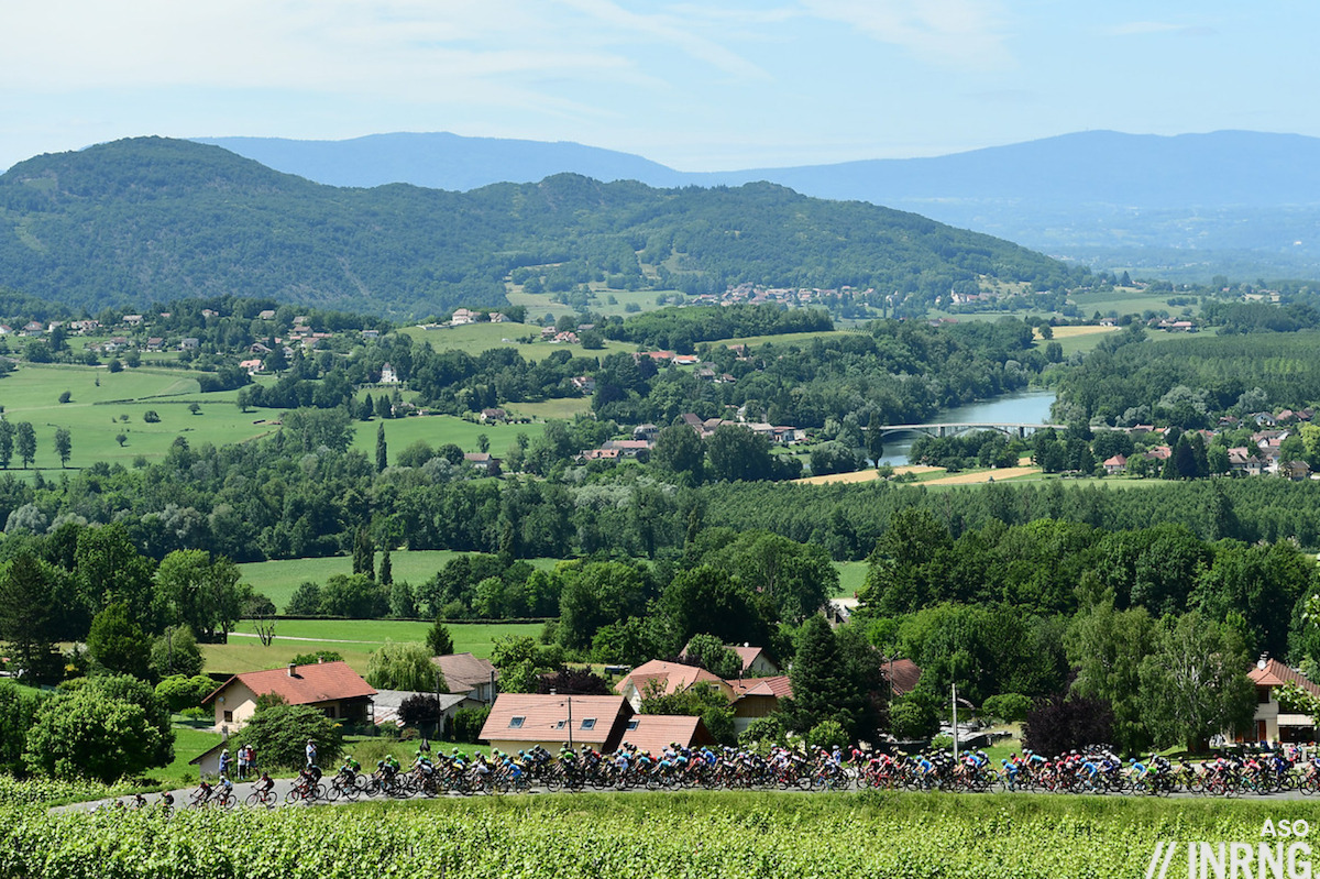
Stage 2 sees the race head for wine country, the Beaujolais and if there are several late climbs they’re not as hard as all the red dots above suggest. These are steady climbs and a good fitness test for sprinters ahead of the Tour de France but it’s this or bust for the sprinters all week. Stage 3 is a 35km flat team time trial, a dress rehearsal for the Tour de France’s 35km TTT.

Stage 4 is one to look forward to whether it’s the recon ride or the TV images as it heads to the Vercors plateau, a great place to ride and often the stage for brilliant racing over the years. The Col de Toutes Aures, real name the Col de la Croix de Toutes Aures is a scenic detour out of the Bourne gorge before the highlight of the day, the Col du Mont Noir which is 17km at 6.9% and with plenty of steep sections before levelling off just before the top, a hard climb on rough roads. The only regret with the climb is taking this route because climbing from nearby Cognin is more scenic but the narrow road and tunnels are probably too much for the race caravan. Then it’s onto the plateau and finish in Lans.

Stage 5 is a test of the legs and the front derailleur. A short stage and fast with much of it spent turning a big gear up the Isère valley before suddenly shifting onto a small ratio for the climb to Valmorel, a ski station summit finish of 12km at 7%. It featured in 2013 when Chris Froome got the better of Alberto Contador after chasing down the lone breakaway survivor Matthew Busche in the final metres.

Stage 6 is the copy of Stage 11 of the Tour de France. The Col du Pré is a gem and arguably better suited to the Dauphiné as it won’t be thronged with crowds and then onto the Cormet de Roselend, its long descent and the steady climb to La Rosière, normally an ascent for diesels but at 110km the short distance of the stage should invite a more punchy finish.

Stage 7 is another short stage and sees the riders retrace part of the previous day’s route before turning off via Megève and then a familiar finish to Le Bettex via the tricky Côte des Amerands and this featured in the 2015 Dauphiné where Nibali came unstuck and the 2016 Tour de France where Romain Bardet took the audacious stage win that put him on the podium in Paris. Interestingly they didn’t copy the Tour de France’s gravel climb, perhaps wanting to preserve the hype or mystery until July.
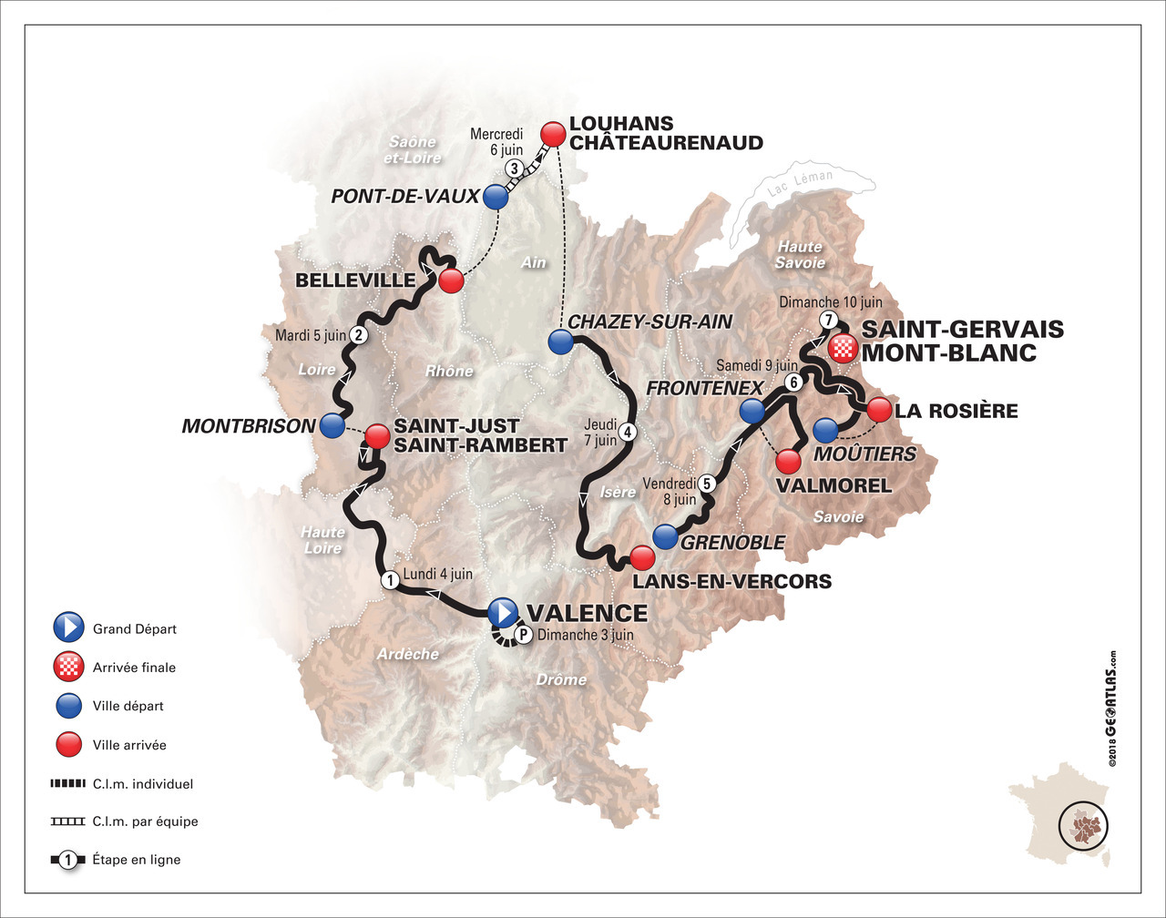
Route summary: Christian Prudhomme opened the presentation quoting Victor Hugo: “in the Alps you are either an eagle or a cretin” and the course is designed for the eagles. A prologue and team time trial and only two possibilities for the sprinters, don’t expect many pure fastmen to show up unless they’re coming for the climbing practice and hope that few rivals turn up. There are four varied summit finishes, three of which come after short stages of 130km or less with the Mont Noir as the novelty before returning to familiar haunts like Valmorel or Le Bettex. Recently the Dauphiné has concluded with a short mountain dash which has made for compelling TV, now they’re proposing three in a row so it’ll be interesting to see who attacks when.
Does anybody know whether detailed stage maps are available or have these not been released yet? There’s nothing on the official web site. I will be in this part of France in June and would like to try and catch a couple of stages.
No maps yet, I get media access and look for them (you get the roadbook, maps, race photos etc) and these will come out later. If the region is new and you want some tips drop me an email as without the maps we can probably work out the routes for now.
Ha, yes, the first thing I did when I saw Col du Mont Noir was to check which side. All are nice, but via Gorges du Nan would have been great.
The last two times I cycled Mont Noir I bumped into French army units doing military exercises …… it’s a fairly remote place. The last time a few young recruits tried to get GPS coordinates off my Garmin but it was using a different coordinate system …. and they were very lost. 🙂
Vercors region is very under-rated. Not the highest altitudes but interesting roads with cliffs and through tight gorges everywhere.
It’s not coming down to the Vaucluse this year, so just booked a hotel in Lans-En-Vercors, some new territory and climbs for me.
Lots of great riding, Will’s site has it all covered. I found the Combe Laval a bit overrated but still impressive and think of bringing lights, some of the roads have unlit tunnels and they’re completely dark inside.
That last photo, it is Pont-en-Royans, right? Looks familiar. Will be passing the place in early August on our day in the Vercors from Grenoble to Die.
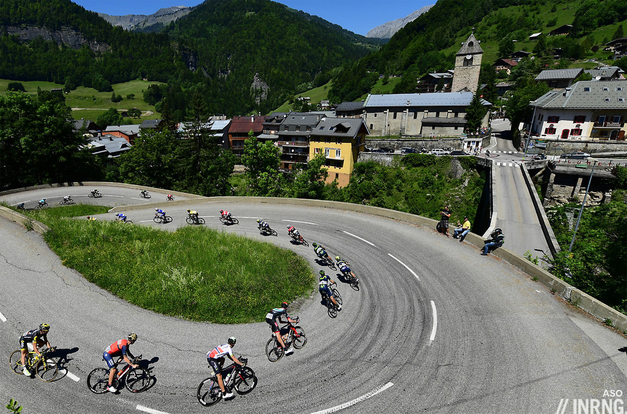
It’s the foot of the Col des Saisies going down into Flumet with the Col des Aravis in the background.
Ah! Thank you. It was raining quite hard when we came down the Aravis four years ago. Cannot remember that coiling road out of Flumet at all. Hoping for enjoyable weather this year.
Don’t worry, it’s not your memory failing you. It’s the other side of the valley to the Col de Aravis.
Love the Mt Noir from Cognin — one of the coolest cliff roads in France. Too bad they won’t be going that way — caravans can be deviated and team motos can sub for support cars for short climbs like this — but at least the Toutes Aures will give a taste of the awesome cliff roads that make the Vercors such a magical place.