
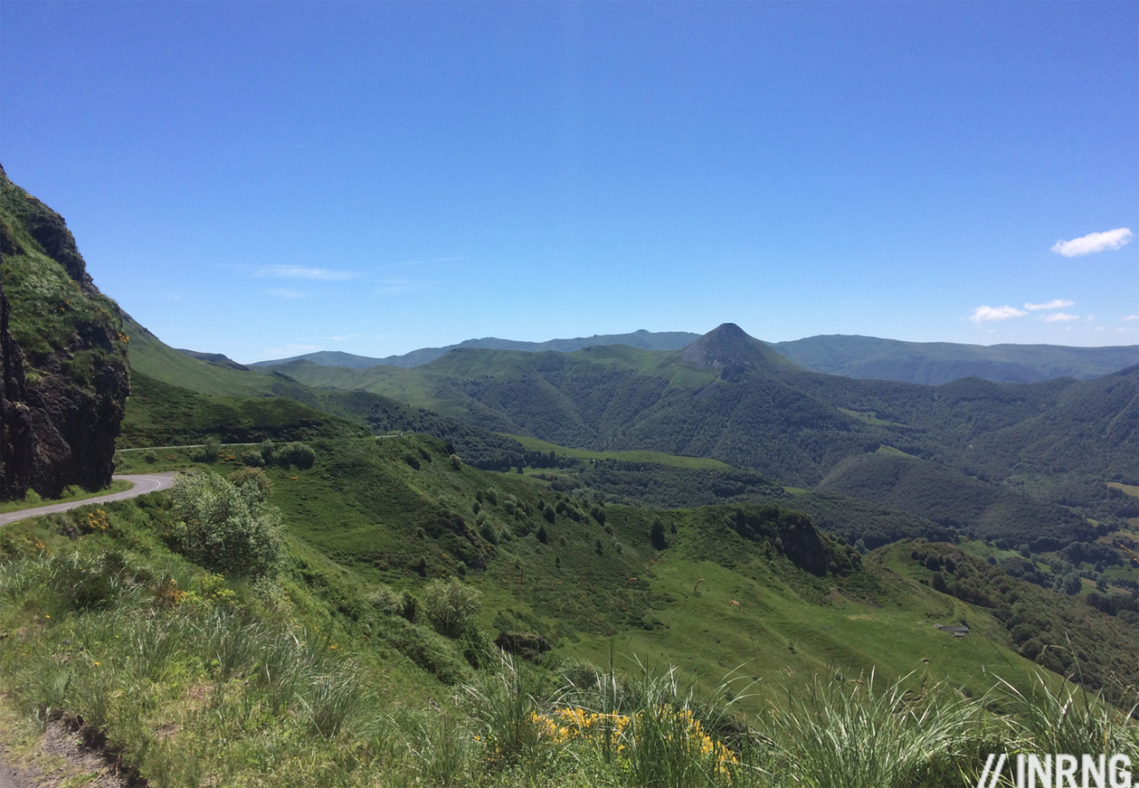
Yesterday’s Tour de France stage was in central France and the Cantal with its volcanic landscapes and lush green valleys. The race doesn’t visit this region very often, few do and all the more reason to enjoy cycling on these roads.
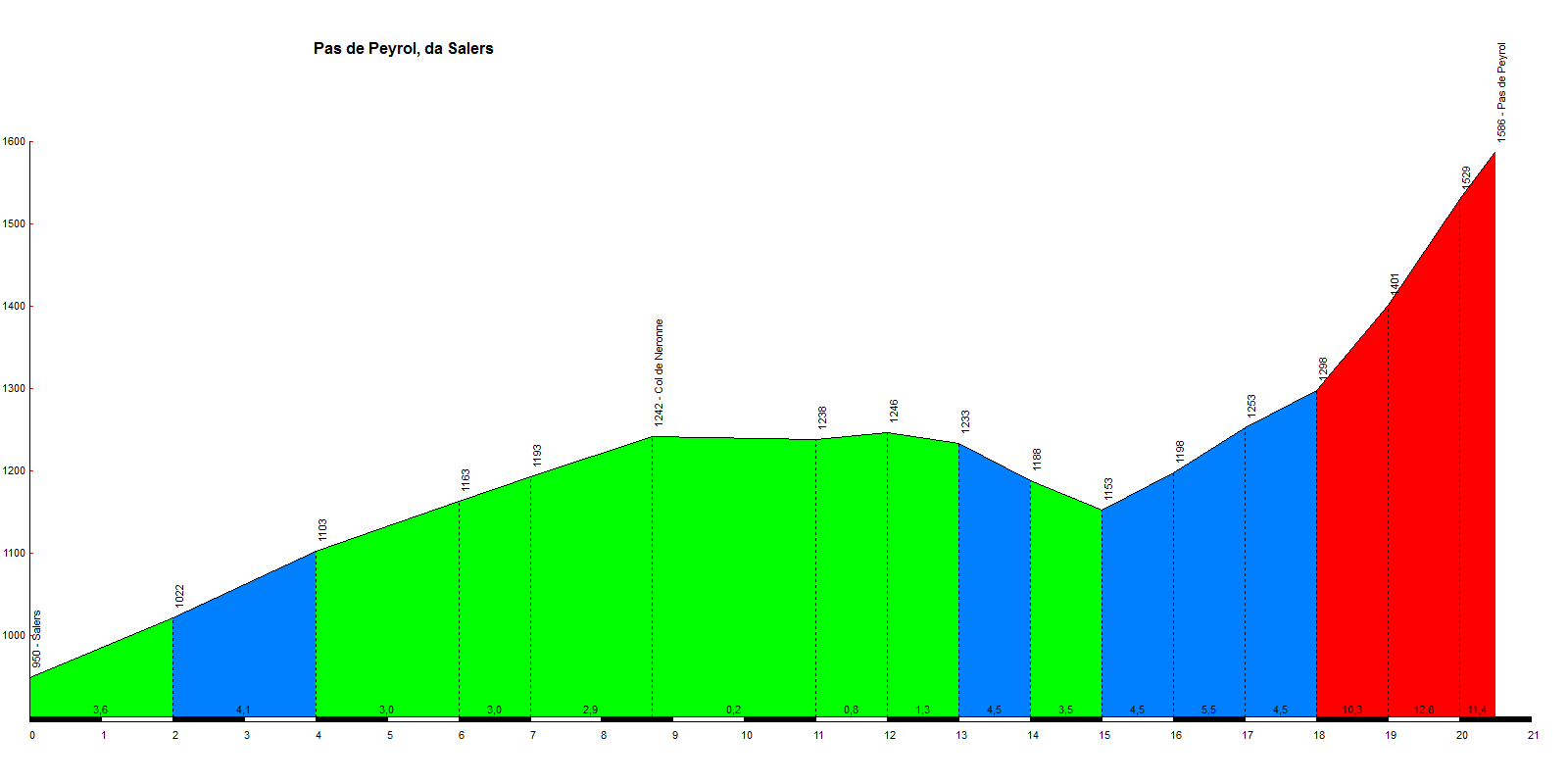
The Route: the D680 heads north out of the town of Salers in the Cantal department of central France and then turns east towards the mountains. This is one route to the top but there are several others, more of which later. From Salers it is 20km to the summit at an average gradient of 4.8%.
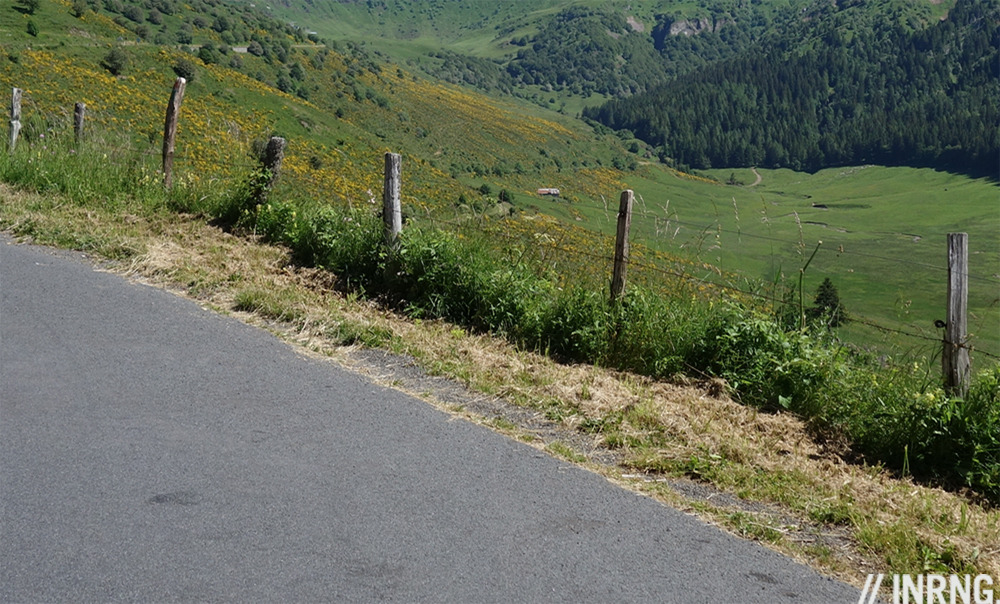
The Feel: Salers is pleasant in the summer but with the sense that it wouldn’t be the same in winter, the buildings are made from dark volcanic stone and must look grim on a wet November day. The road starts climbing straight away. This is a land of a million wooden fence posts strung with barbed wire. They keep the local cattle in the fields but for the cyclist it’s hard not to imagine strips of Vacansoleil-DCM kit dangling on them as this is where Johnny Hoogerland was rammed off the road during a stage of the Tour de France.
The Col de Néronne is the first part of the climb, the road rises up the side of the U-shaped valley, a geography lesson on wheels with rock features galore. It’s fast, the gradient is 3-4% and the top of the pass is visible from afar but it pays to look around, it’s the views to the side that are best. The pass arrives quickly and isn’t the crossing point you normally associate with a col as the road simply carries on, there’s not much of a descent to come. It could be New Zealand here, the volcanic terrain turned green thanks to abundant rainfall and there’s more livestock than people. The comparisons end the moment you pass a house or a farm building, many are ancient and the more you look, the older they appear. Those slate tiles on a roof appear to have been cut by hand; a big iron key sitting in the lock on the front door. This feels like time travel, you half expect to meet a horse and carriage going the other way only for a camper van to appear instead, and your phone gets a strong signal.
The road resumes climbing with a gentle slope. Spot the bridge and the warning sign for cyclists to announce what’s coming and if if those clues are not enough, look up above you and you can see the top of the pass and it’s worryingly near. Normally near is good, but this is near, as in above, rather than across and you quickly discover just how direct the road is as it rises to 12% and barely relents for the next three kilometres. Once the trees give away the gradient is steep and the road bends around to the right with a long ramp up to the pass, there are sustained moments at 14%. The views are stunning but focus is on trying to make the top of the climb. At the top there’s a small café and tourist halt along with a view point. You can continue in different directions via other passes.

The Verdict: a great climb amid some impressive scenery. By itself it’s not going to draw people in the same way Mont Ventoux is a destination for thousands of cyclists but climb up and the best part is yet to come, once at the top you can choose where to go next and to explore other parts of this unusual landscape.
The History: the Puy Mary was first climbed by the Tour de France in 1958 and has now been crossed nine times by the race. It’s never been as famous as its volcanic cousin the Puy de Dôme which sits 75km north and has hosted legendary summit finishes but that’s been closed to the Tour and cycling in general.
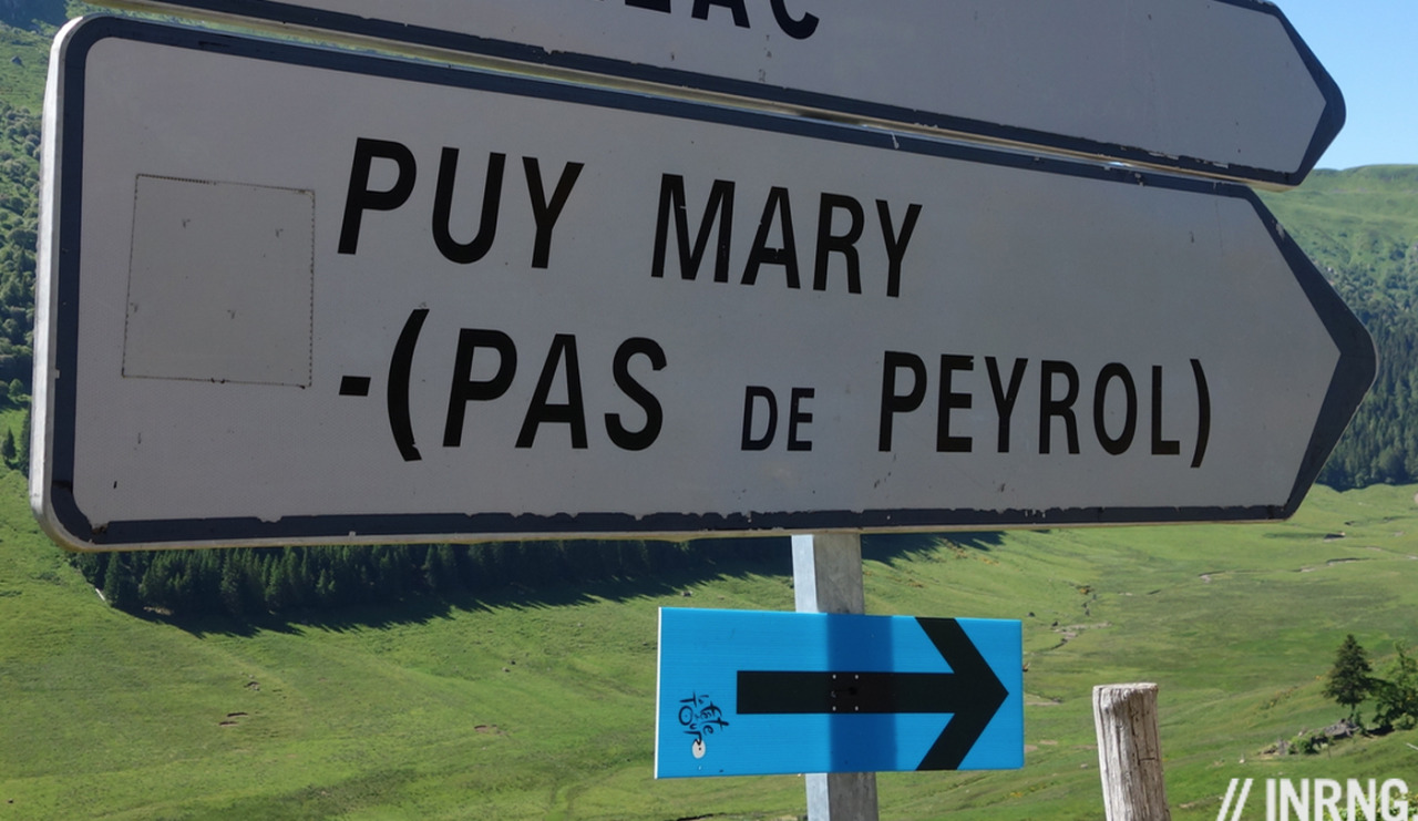
Puy Mary vs. Pas de Peyrol: the Puy Mary is the mountain, an extinct volcano and puy is the local word for a peak. Pas de Peyrol (“Peyrol step”) is the pass where the road goes.
Volcanos: they’re all extinct of course, in fact they were active so long ago that erosion has taken its toll, to the cyclist the Puy Mary looks like an ordinary mountain. However the rest of the region is dotted with cones, lumps of dark volcanic rock, spa towns with hot water, and other clues to the past.
Ride more: describing the “Tour de France route” above is a pretext to introduce one climb among many. The Puy Mary has three roads leading to the pass and these each have their own approach roads and so on: the longer your ride the greater the options. If you enjoyed the scenery on television there’s so much more, the best thing is the choice of routes in the region. You could spend a week doing routes that cross the Pas de Peyrol as a central feature if the day only with different directions, loops and side roads or you can skip the big climb and go in other directions, crossing all sorts of other mountain passes and saving your knees as most of the other climbs are between 3-8% rather than the more savage slopes.
Travel and access: Salers was listed as the start point but take your pick from many towns like Riom with its wines, Murat at the foot of the road to Le Lioran and other passes, or the larger town of St Flour. There’s autoroute and rail access to the region and trains but little in the way of international airports, Clermont-Ferrand is the closest big city.
Picking the right time of year matters, this is one of France’s wettest regions as incoming damp air from the Atlantic rises and cools over these peaks to pour down. The lack of altitude means these roads are not closed for months on end over the winter but the probability of rain means that this region is not necessarily viable in, say, March or April if you want some early season climbing. Better to visit in the height of summer.
More roads to ride at inrng.com/roads
It certainly looked like a nice area yesterday, the weather certainly played ball for them. It did look exceptionally green though. The climb looked brutally steep on TV, like some of the incredibly steep climbs they put in the Vuelta. No suprises to see Purito do well yesterday!
Extraordinarily green.
I was thinking the landscape was faintly reminiscent of one I’d seen before, maybe a mix of the Forest of Bowland and parts of the Peak District.
But then I remembered; it was the land in the Jurassic Park film, the one where the herd of Brontosaurus are on the hoof 🙂
Why did BMC let Van Avermaet go on ahead Wednesday? Isn’t that burning one of their matches for the GC? I can see a team with no real GC contender wanting to grab the yellow, but might not TJ or Richie need him at some point?
Sky and Movistar seemed like the only teams totally concentrated on supporting their GS men. To see Valverde turning his head to check on Quintana as they came down the stretch, tells me Movistar is especially focused.
I know, frivolous compared to hard cycling, but the glorious French countryside and small historic towns are just plain a pleasure to watch. And for a day off, not far from the Cantal is La Chaise-Dieu, handsome small town with wonderful old abbey (rebuilt for a pope; great name too, ‘seat-of-God’) and first-class summer music festival; and not far from today’s route through the Rouergue-Aveyron is another wonderful romanesque abbey church in the small town of Conques. (No money changed hands, I just love these places; but INRNG is right that they can be cold, bring extra wooly socks even in August.)
Been there, done that, loved it. (twice – in 2012 and 2013…)
Cantal is is my favorite cycling region in all of france. Climbs are not too long andsteep – they are either short and steep or long and easy, not too tall to be cold at altitide. The major tows Auriliac and st. Flour are pleseantly small and trafic is almost non existant as long as you stay away from the route national from Murat to Auriliac throug Cantal. And Pas de Perol the most beautifull pass in all of France…
Be aware, even thoug you only pass a mountan pass or two there will be tons of climbing.
It was a Google search for Alpine climbs that first led me to find Inner Ring via the Roads to Ride features. Great to see a new one.
This August, I’m going to be staying 100km West of Puy Mary in Brive la Gaillarde. I think I’ll have to pack an extra flapjack and ride out to Puy Mary.
Does anyone have any recommendations for other rides around Brive?
The Vézère valley north of Brive is nice, but so wild the road doesn’t use much of it. You can trace a route to Uzerche and back going in and out of this. More touristy but pleasant still is the Dordogne valley to the south, bigger roads. The Causse plateau to the south is worth exploring too for the landscape, the stunted oak trees and arid nature.
Merci beaucoup
Brilliant M/Mme Inrng! So many Roads to Ride and so little time – this article has made me add yet another, thank you.