
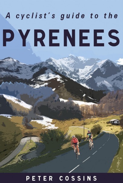
A Cyclist’s Guide to The Pyrenees by Peter Cossins
The Pyrenees stretch from the Atlantic to the Mediterranean but chances are if you asked cyclists to name the famous climbs they’d pick a few like the Tourmalet, Soulor, Aubisque or Luz Ardiden. All good but they’re all French and within a narrow central band of the this large mountain range, there’s more to discover, and on both sides of the Franco-Spanish border. This book is a very practical guide.
You might have some concerns about James Hilton’s 1933 novel Lost Horizon and the Frank Capra film version from 1937 but the idea is that hidden behind a mountain somewhere there’s a lost paradise: the Shangri-La. Alas there are no unexplored parts of the Pyrenees but there are areas out of mind in the road cyclist’s psychogeography. The book starts on the Mediterranean side and picks out the Galamus gorge as the first ride:
“This route may not feature any noted cols, but in less than 50km it packs in more natural and historical splendours than almost every other ride in this guide”
A bold claim but it try it for yourself. Take the D7 road north out of Saint-Paul de Fenouillet and there doesn’t seem to be anything special ahead as you climb past the vin-de-table vineyards. Until suddenly you round a corner and you’re on a tiny road cut into a breathtaking cliff that could not be imagined minutes before, how did this happen? Luckily if the book starts with a gem like this there are more than 120 suggestions to browse, ranging from 35km to 190km with lots of detail and intrigue. The routes are suggestions and often overlap so you could link them together to make a longer loop.
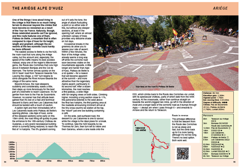
Each ride has an identical format with text and the accompanying route profile, map, a photo and a a barcode. The book comes with QR codes which you can scan to summon routing files for a GPS bike computer.
“A book? I can use mapping software for routes”. The text is full of knowledge which is what makes the book so useful. Sure Strava’s Heatmap shows where cyclists pass but this is partly a function of the number of cyclists around, just as a food heatmap would show how popular supermarkets and McDonalds are, when you might prefer something with a local flavour instead during your travels. Here’s one detail:
join the D115, which climbs into woodland at Grailhen as it tracks northwards towards Lançon. There are alternative routes northwards in the bottom of the valley, but I prefer the tranquillity of this one, even though it does add 150 or so vertical metres to the total
Yes it’s in English and published in the UK but the author lives in the Pyrenees and it reads like it was researched and produced on the ground. It’s like having a local guide.
So far so good. But note two things, this is very much a ride guide for road cycling although there are some gravel suggestions in places. It’s also very practical, a handbook with factual details on the climbs, descents and roads in between, don’t buy this expecting the gloss and glamour of a coffee table book.
The Verdict
Detailed and thorough, this is a guide for anyone planning a road cycling trip to the Pyrenees, whether it’s to tackle the Tourmalet, amble around Andorra or galavant about Girona. If that’s you, then you might have some famous climbs in mind already but this should give advice and choices. Even a local who knows their patch in the Pyrenees would do well to explore other parts with the help of this book.
- Note: It’s published in the UK by Great Northern Books and sells for £16.99. I asked for an electronic copy free for review
More book reviews at inrng.com/books
So pleased to think the Inner Ring is a bit of a film buff!
A book and film about the mountains is always going to be of interest here whether it’s finding a hidden utopia… or suggesting roads in the Pyrenees which can be the next best thing.
The quoted parts of the book are in almost the same shade of grey as their background making them very difficult to read. At least to an old bloke with shoddy eyes on Firefox (88.0.1).
Is it awkward for other readers? Tried to make the quoted text a shade darker but the tech side of doing this isn’t so easy.
It’s readable for me but is a bit on the light side of things (on my very old Macbook Pro with retina display and running Chrome). Perhaps italics and full black text would be better.
Agree. You can also play around with font size as well.
Readable but faint. Certainly they don’t standout from the regular text as you’d expect pull-quotes should
My copy arrived last week and have been going through it over the past few days. Overall, i’m very positive. TBH i think the maps are too simplistic and need a basemap (that’s even with the QR codes provided). Would also be nice to have an overall map at the start/end to orientate the different regions etc. However, i think these are minor gripes and it’s obvious a lot of thought, experience and effort has gone into the book.
Good points. I was interested in the book as I like the area a lot and know the area a bit so where the places was more obvious but a wider map would be a good idea.
I think that I might well buy this book, because of the review.
(Gallivant, not galavant, I think)
Love the Pyrenees. I’ve done the Raid (Atlantic to Med) which was fantastic and I’ve done a training camp in the valley around Bagneres du Luchon. I’ve also hiked some of the Grand Randonnes routes. It’s a magical place which has preserved much of its rural charm. An area peppered with strong regional identities which reveal the anthropological upheavals this region has been subject to. Basque, Visigoth, Catalan, Romans and Cathars! These are etched into the landscape and make the place legendary. A great place to explore, whether on foot or by bike.
If you want an example have a look at the Breche de Roland, that’s a rabbit hole to walk down. There are a number of churches which claim to have his sword Durendal.
I have Cossins’ book on the monuments so may well check this out.
On my first proper bike trip a few years back in the Pyrenees I asked a man who I heard speaking English to take a snap of me atop my first ever real col – the Col de Menté. He had a name sticker on his old alloy TCR which seemed vaguely familiar. Googling it later and of course, it was Peter Cossins. I’d seen his name atop a few articles in the cycling press. A great journalist and Pyrenees local. I believe he lives near Foix.
Despite the glory of the high passes, my favourite part of the trip was out in the Pays -Basque, especially the areas to the west of St-Jean-Pied-de-Port
I think the Col de Menté is on the cover.
One of my most memorable rides was in an isolated area west of St Jean Pied de Port, heading to Etxalar from Urdax. I rode for a considerable time without seeing any living creatures except birds and horses. It did require a bit of judgement at one lonely intersection, but fortunately I chose correctly. It’s beautiful around there, quiet and almost wild, with stunning views from the peaks. This was part of a too-short stay in Sare, which turned out to be a terrific base for exploring the area. I’m very keen to go back and ride from there to the Alps and on to Italy, and this book sounds like just what I need.
The article and quotes all look fine on Android phone.
The book looks interesting. I really enjoyed the author’s last book “Full Gas” about tactics in the Peloton. I was reading it around the time the TdF was on and it really illuminated the race, I was much more inclined to watch the stages in full albeit with a wee snooze or two along the way
D25 through Lançon is lovely, but don’t even think of getting there on the D219 up from Arreau unless you’re rocking a 36×35 🙂
In cycling guide books, I find you get three types – the gorgeous (coffee table books like mountain higher, great with glossy pictures), the bad (poor text, grey photographs – Rapha do a few of these), and the useful (books you’ll keep coming back to like Rudolf Geser – Alpine Passes). This definitely fits in the useful category, and in doing so fills a definite void. Great that it doesn’t just lean on France, but covers both sides of the border. Baffled though why it reads from east to west, this feels so un-natural. A few other bits – it could do with some bigger maps, an over-all map to break up each section etc. A book I’m sure to return to again and again. Solid 4/5.
Call me selfish, but I wouldn’t want many people to know about my favourite spots in the Ariège department and in the Huesca province…
Hope anyone planning to ride there checks the weather patterns – back-in-the-day we worked on a tour of the Pyrenees where it rained seemingly every day. Clients got very tired of playing cards in the hotel dining room or just sitting around watching it rain. We asked (out of earshot of the organizer) about the weather and were told, “Yes, this is the rainy season here, didn’t you know that?”
We guessed the organizer never bothered to check, instead just putting the tour in a spot on his calendar that worked for him? As part of the staff I’ve never been so wet and miserable though we’d spent plenty of time there in good weather while following LeTour over the years.
The Western Pyrenees are very dry, and the Southern Pyrenees are generally also much drier than the Northern side.
Ferdi – now you’ve got me trying to remember when that tour was produced? It was the final one of the season and I can still remember packing roof-rack parts away in a driving rainstorm the night before we flew home. The tour started in the east as I recall and moved west and must have been in August if my memory is correct.
That was 3+ decades ago so perhaps weather patterns have changed but I remember a client telling me later his bike’s freehub was seized up with rust when he took his bike out of the box upon his return to the USA! It really was an awful week.
Some rainfall & temperature maps for the Pyrenees between 1950 – 2010 https://www.researchgate.net/publication/309154188_Trends_in_temperature_and_precipitation_in_the_Pyrenees_range_over_the_period_1950-2010_Studying_the_climate_of_the_Pyrenees .
The Basque end is pretty wet and the Catalan end pretty dry, I thought the south side would be dryer than the north side (has always looked like it to me) but these maps suggest not. This is only to 2010 but no reason to believe the trend towards dryer and hotter has not continued.
Pretty much anywhere on the western edge of Europe from Portugal to the north of Scotland can be wet anytime of year. Memories of very wet childhood holidays in Devon & Ireland, that was in the summer let alone the autumn.
You can see the difference, the west is lush like the Basque Country although it dries up from June onwards, the eastern end has cactus plants growing by the road and plenty of snakes sunbathing on the road. The eastern end though can be very windy in the spring.
Right. When I wrote Western I meant Eastern…