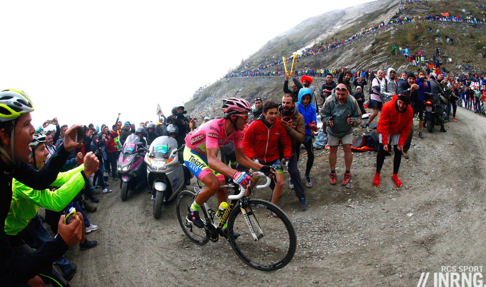
The Giro’s route for 2015 was announced earlier this week and one highlight is the Colle delle Finestre, the highest point of the 2015 Giro and unpaved too. What’s it like to ride?

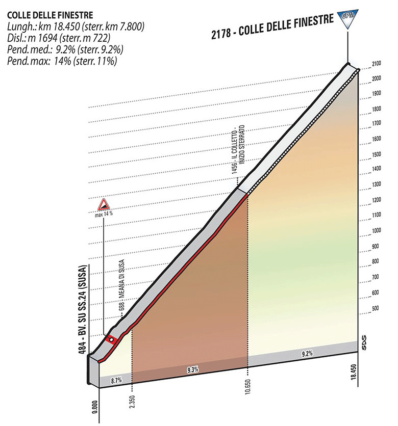
The Route: there are two sides and this is the northern side from Susa, the Giro route which allows you to climb the unpaved section, then descend on tarmac. It is 18.6km at an average of 9.1%. After Susa, follow the signs for Meana and the Colle delle Finestre.
The Feel: it’s famous as “the unpaved climb” but you start on a wide road, the tarmac blacktop neatly framed between two white lines like every other road in Italy. The profile above looks linear but the early section to the village of Meana is steep as it passes through a short tunnel. Maybe it’s the way you can see the gradient in different ways? Garden fences climb the slope like ramparts. A parked car sits with wooden chocks as if the owner doesn’t trust the parking brake. You might think the hard bit is the gravel but the early section is the steepest.
After three slow kilometres you leave the village for forests and the long road you’re going to stay on for some time. Get into a good gear and a rhythm. It’s very regular and you can thank the military for this. Rather than an old path used by shepherds or smugglers that gradually became an accepted crossing point, this climb was built by the army. The military specification was a regular slope so horses could drag cannons up. Steep but even.
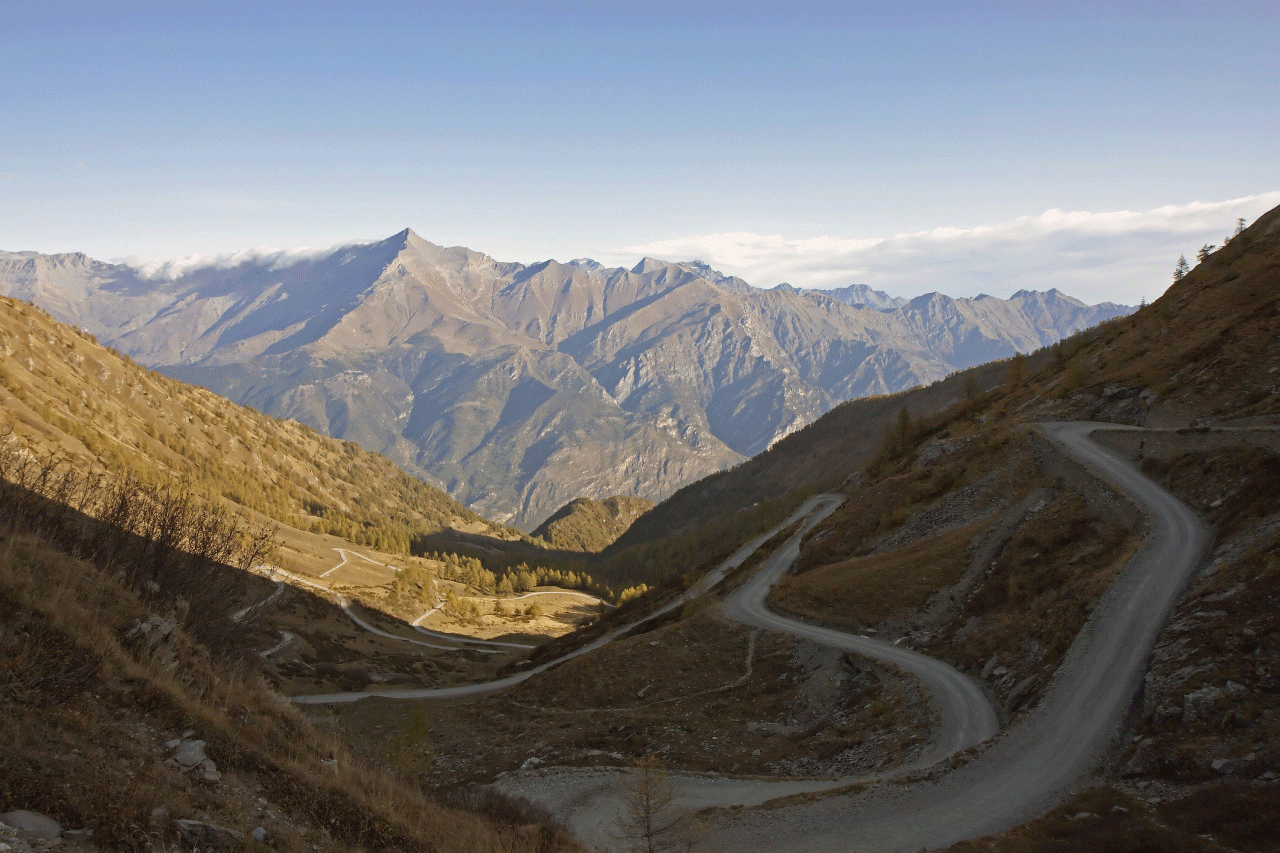
Did you grease your headset? Maybe it’s worth thinking about this humble component because you’ll swish your way up, there’s a section with more hairpins than Beyoncé’s dressing room: 30 in 3km if you want to count. One benefit is you always have something to aim for and you can chose your line: out of the saddle on the inside if you’re in a hurry, or ease around the outside to spin the legs. There’s a Lilliputian aspect as the narrow roads and regular hairpin bends make the road feel almost too small.

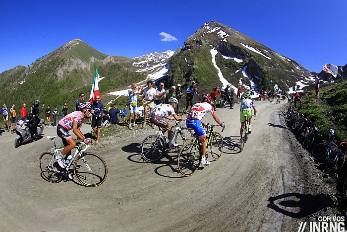
The unpaved section starts suddenly. Here there’s no gradually crumbling road that slowly gives way to gravel, instead a picnic table and a wooden sign mark the start of the sterrato. For the road cyclist it’s only briefly disorientating. Presumably you’ve picked a good day to ride up – otherwise you’ll freeze on the descent and miss the views too – so the road is dry and as you’re going uphill few skills are required beyond looking out for obvious fist-sized rocks in the road. The unpaved section is gravelly but not rocky. You wouldn’t drive a Ferrari here but on a Sunday you’ll see families in a Fiat.
The further you go on the rougher the road gets but try not to look down at what’s passing under your front wheel as the views open up above the tree line and the sights get better and better.

The Verdict: a tough climb thanks to the distance and consistent gradient rather than the gravel. It’s easy to fear the unpaved part but it’s the entirety of the climb, the full 20km that takes its toll. One of the hardest climbs in the Alps. There are paved climbs with rougher roads that match the distance and gradient, for example the irregular 2,481m Colle Fauniera lies to the south with its cracked and crumbling road surface. Save something in reserve to enjoy the views at the top, preferably looking at the peaks on the horizon rather than the awkward Danilo Di Luca commemoration stone perched at the top of the pass.
Bike Tech: the Giro has gone up but they have following cars. Ordinary riders can use this road without reservation, just preparation. If you’re a weightweenie trying to save every gram this isn’t the place to try the lightest wheels and the finest rubber. Otherwise just watch your line and you’ll be fine. Pay more attention to the weather as it would grim on a wet day. Think about letting air out of the tires for more grip on the gravel but a tiny pschitt and no more.
When? In 2011 the Geox team captained by Dennis Menchov went for a recce ahead of the Giro only to get stranded in the snow. As the sign says the road is open from June to October. Pick a dry day with blue skies for a great experience. If you can choose any time of year September offers landscapes that glow a golden hue in the late season sun.
Loop: the descent is paved so continue to loop clockwise to Sestriere, Cesana Torinese and Oulx to rejoin the Val di Susa for a manageable 100km circuit.

History: there are two elements to this. One is the history of these valleys and the pass itself, and there’s cycling and the Giro:
- This part of the Alps was the heart of the Kingdom of Savoy, a land that stretches across what we know today as Italy and France and for a while one of the wealthiest and strongest regions of Europe. It’s still doing well today, but in the past huge forts guarded the mountain passes and the Fenestrelle Fort is the biggest in the Alps and it sits below the pass. There’s a smaller fort near the top off the pass which you can see on the approach
- The Dukes of Savoy built up a kingdom that eventually included all of the Italian peninsula until a referendum in 1946 opted for a republic. The ruling family had used light blue, or azure, on their emblems and heraldry and to this day Italian athletes representing their republic turn out in the blue tones of the old monarchy. This is why those on the national team are called azzurri, the “light blues”
- The first visit was a dream come true for Giro boss Carmine Castellano who stopped running the race in 2003 but his sadism laid the work for this climb to be included in the Giro two years later in 2005, one of the most thrilling editions in modern times. The Giro’s visit was enough to get the climb partially paved and the descent fully tarmacked. The race returned in 2011 and will be back next summer.
Say It: Finestre is Italian for “windows”.
Travel and Access: the nearest big city is Turin, 50km to the east. An industrial city, it has plenty of charms and history. Milan is the main point for international access with, Lyon, Nice and Geneva all nearby adding more connections by rail and rental car.
The climb starts in Susa which is easily accessible by autostrada and there’s a railway line too. Susa makes a good base given the other climbs in proximity like the Moncenisio, aka Mont Cenis. There’s a compromise as the more you base yourself near Turin, the more options you have within driving range as other valleys become accessible but the fewer mountain passes there are within range if you’re cycling. So Susa if you’re there for a couple of days but for longer you might want to move around are base yourself in Turin.
Photo Credit: main image by Flickr’s Eric 81
More roads to ride at inrng.com/roads

I rode this route in July 2011 along with the Sestriere to make the loop. It was as INRNG describes, except that depending on how dry the weather has been and how many cars have gone up since the last rain, the hairpins in the gravel section can get very loose and tricky. I think the road was graded and spruced up for the Giro, but two months later when I rode it, the condition of the steeper corners near the top made it difficult to ignore what’s right in front of your wheel to enjoy the fantastic scenery. The tarmac descent down the south side is fabulous, but the road is very narrow.
Daniel Friebe’s book “Mountain High” reviews this climb too – it’s a great book and the Finestre is one of the best-written pieces in there I thought – and he says the climb was almost overwhelmed by the race and the fame in the following weeks so this could have had something to do with it. Hopefully it is calmer now but the season’s ending and it won’t start again until the Giro next year when it’ll be so busy again.
Nice review! We’ve taken small groups over this pass a couple of times with our support van as well in addition to riding it ourselves. On race day the surface is rolled smooth, even riding back down after seeing the Giro pass is easy. The rest of the time it’s a bit tougher, a lot like the strade bianche of Tuscany, but I’ve ridden sensibly inflated Vittoria Open CX tires up it with zero issues. We’re already planning a return visit for May 2015. Don’t miss the focaccia di Susa if you go, a large slice of this and a cappuccino in the morning will get you up the climb for sure!
I loved this climb. Long, hard, and very quiet. So remote.
At the Col, just above, you can walk to a little rock garden with little monuments to famous Italian and French cycling climbs. (Sort of cool, and a lot nicer than the two Di Luca monuments) . Here is a photo of the Galibier with Mortirolo, Gavia, and Stelvio behind: https://www.flickr.com/photos/willj/5762877112/
Not sure if recently resurfaced, but Fauniera seemed not too bad a surface this summer (only saw 2 of the 3 sides).
It’s nice to see all these commemoration stones, they take the time record what happened in the race. Only they’re engraved with names like Di Luca and Menchov.
I did the Bra > Borgo San Dolmezzo Giro stage route a while ago and the Fauniera was wild from the Pradleves side, the road crumbling in places lower down (after the Bartali hairpin) and then again further up on the narrow section. But once over the top the descent to Demonte was fine, one or two potholes but generally smooth and fast.
I rode the Pradleves side and the Demonte side. They must have repaved because the surface was fine above the Bartali hairpin. Always good news when a great road gets a little help.
Honest question: what about climbing the tarmac side with CX tires? Descending those turns look spectacular. I know ‘spectacular’ is over-used but, ohhh boy that looks like downhill fun with some 42c ‘cross tires. The dirt road is too groomed for a mountain bike.
I have a dirt climb on the col de parpaillon on my bucket list too.
Why not? But at your own risk as there are no security barriers, one mistake can cost you more than a tire or a wheel.
The Parpaillon sounds wilder, I don’t know it but from the talk/pictures it’s something harder and they couldn’t take a race up there.
The north side of Parpaillon (the harder/bigger side) is in many ways similar to Finestre. 1) A huge climb (26 kms with more than 1800m ascent). 2) Very remote. 3) Old military road: used to be highest in France pre Galibier (Tunnel is 5m lower than Galibier summit). 4) Last 10 kilometres are unpaved .
I found it quite a bit rougher surface than Finestre, especially the first few unpaved kms. But was no problem with 35c tires. Tough to see it being ever used by TdF without a little face-lift.
IMO: this is is a nice site: http://www.cyclingthealps.com/
Interesting point about the unpaved section being ‘flattened’ for the Giro, I had no probs riding up it for 2011 Giro, but this year couldnt make it, had to stop and turn back as soon as I hit the ‘hardcore’ section, was on Michelin Pro Race 3 tyres :-/
Pro3 are maybe worst choice for gravel from racing tires. I destroyed quite a few only with occasional debris from roadside. They are very prone to cuts. Apparently Michelin learned a lesson and Pro4 are much better (still only average).